Farming’s always been about timing, soil and sweat. But now, it’s also about data and decisions. Australian growers face big pressure—from weather swings to rising input costs—and the margin for error is shrinking. That’s where agricultural drones are making a real difference.
These drones don’t just fly. They capture detailed images, spot crop issues early and guide smarter farm planning. And in the hands of the right operator, they help turn a good season into a great one. But to make the most of drones, farmers need to understand how to use them properly, what they can do and where they fit in the big picture.
Let’s break it down.
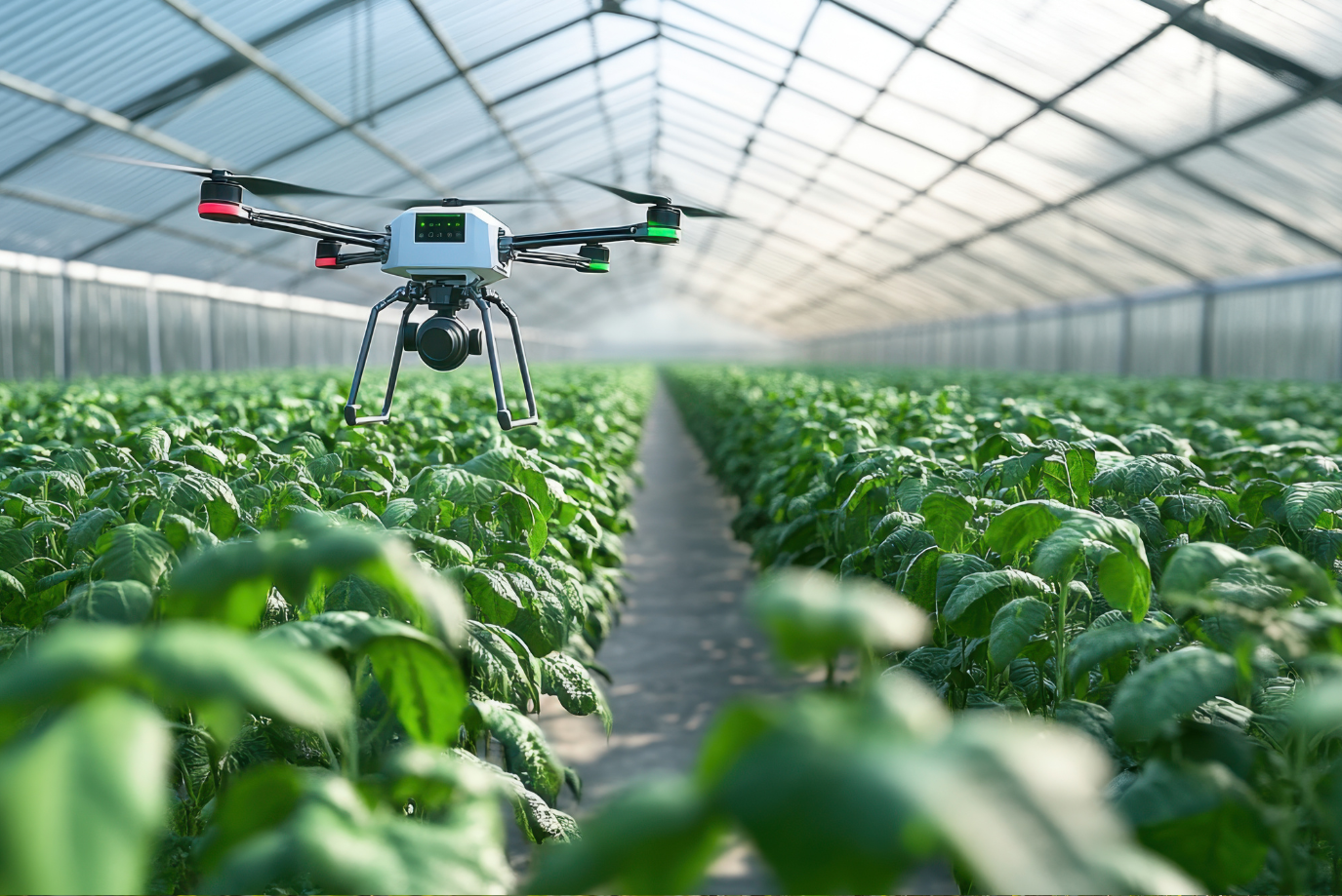
Smarter Crop Monitoring with Drone Imaging
A healthy crop starts with knowing what’s happening in your paddock. Drones bring that clarity. Equipped with multispectral or RGB cameras, they scan fields in minutes. These images show patterns the human eye misses—pest outbreaks, water stress or nutrient gaps.
You’re not waiting for a problem to become visible on foot. With drone mapping, you can act before it spreads. That’s what sets drone tech apart—it shifts growers from reactive to proactive.
Here’s what farmers are doing right now with drone imaging:
- Identifying early signs of disease in high-value crops like cotton
- Pinpointing dry patches in broadacre fields before it hurts yield
- Tracking growth rates across zones to adjust fert plans
Using these images alongside agronomic advice has led to noticeable yield bumps. And the best part? It’s fast and non-invasive. A 20-minute drone flight can cover hectares that would take hours on foot. That’s the power of enhancing crop monitoring with drones.
Precision Planning through Zoned Analysis
Once a drone maps the land, the next step is using that data to guide action. Through zoned analysis, farmers can divide their fields into sections based on plant health, soil condition or past yield trends.
Each zone gets treated differently. Some might need more nitrogen. Others might get skipped altogether. This approach—called variable rate application—is a core part of precision ag.
For example, in a wheat paddock, drones picked up poor NDVI scores in one corner. The farmer cross-checked the zone and found compacted soil. By deep ripping that area and adjusting fertiliser, yield in that section lifted 18% the next year.
This targeted farming doesn’t just boost yield. It cuts waste. Less spray, less run-off and fewer reworks. With margins under pressure, every input saved matters. And it’s all guided by drone-captured insights. That’s why precision agriculture and the role of drones go hand-in-hand.
Time Savings That Multiply Over a Season
Running a farm means juggling a dozen jobs before lunch. Drones help lighten that load by doing scouting faster, smarter and safer.
You don’t have to walk every row. You don’t wait for crop symptoms to become obvious. You send up the drone, get the map, make the call. That efficiency frees up hours across a season—and in peak times, that’s gold.
A case in point: a mixed cropping farm in northern NSW used to spend 2-3 days per week checking irrigation across its plots. After switching to drone surveillance, it got the same job done in under an hour, twice a week.
The result wasn’t just time saved—it was faster response. They fixed blockages the same day they happened. That helped keep moisture levels stable during flowering, lifting yield by 12% in their canola.
If you’re wondering how drones boost productivity on farms, this is it. Less legwork, more real-time action.
More Effective Spraying with Drone Application
Not all drones are watchers. Some doers. Spraying drones are now being used to apply herbicides, fungicides and foliar nutrients. These machines fly low, work on tough terrain and can treat tight zones with precision.
This is a game changer in hilly or patchy blocks. Traditional boom sprays can’t always access those areas, especially after rain. But drones can, and they don’t crush crops while doing it.
Farmers using spray drones have cut chemical costs by only treating areas with confirmed infestations. That’s better for the crop and the environment. Plus, drones can fly during early mornings or after rain when ground rigs are sidelined.
As battery life and payloads improve, drone spraying will keep growing. Already, broadacre farmers are using them for late-stage touch-ups and weed spot treatments. And for vineyards or tree crops, they’re a natural fit.
Better Planting with Drone Seeding Systems
Drone seeding isn’t science fiction—it’s already here. In trials, drones have been used to seed cover crops or plant into burn zones after bushfires. They carry seed pods that drop with GPS accuracy into the soil.
It’s fast and flexible. A drone can seed rough or remote terrain that would otherwise be skipped. This is especially useful for regen ag and carbon projects where ground disturbance must be low.
While still a developing area, drone seeding offers exciting potential. With automation and mapping, it can support smart replanting strategies, especially after hail, drought or fire.
Drones and Data Platforms—Working as One
The true power of drone tech shows when it links with digital platforms. Mapping tools, farm management software and AI analytics all feed off the same aerial data.
With good setup, a farmer can fly a drone in the morning and have actionable insights by the afternoon. Fert rates adjusted. Scouting plans set. Spraying zones mapped.
This sort of connected workflow is becoming more common, especially on larger farms or corporates. But it’s spreading fast. Platforms are now more affordable, and support services are helping smaller growers make sense of the data.
The key is not just collecting data—but knowing what to do with it. And that’s where good training, trusted advice and solid systems all come in.
Adapting to Weather Changes and Stress Events
One of the toughest parts of farming is dealing with the unexpected. Heatwaves, storms or droughts don’t follow your plan. But drones help you adapt faster.
They can fly after storms to check for lodging, damage or erosion. They help spot irrigation leaks during dry spells. And they monitor canopy health during extreme heat.
These fast checks give farmers time to act—whether that means changing irrigation patterns, rescheduling sprays or protecting stressed crops.
For example, a Riverina grower used drones to check sun damage after back-to-back 40°C days. The drone data showed early wilt in certain corners. That led them to adjust irrigation cycles and save the remaining crop.
Drones won’t stop bad weather, but they give farmers the tools to respond smarter when it hits.
The Future: Automation, AI and Fleet Control
Looking forward, drone tech is set to get faster, smarter and more autonomous. Fleets of drones working together will handle crop monitoring, spraying and even pest detection with minimal input.
AI is being built into mapping tools to give clearer recommendations. Instead of just showing a heat map, future software will say: “Add 30kg/ha nitrogen in Zone 2B” or “Apply fungicide in the northeast corner by Friday.”
Autonomous recharging, smart flight planning and even voice-activated scouting missions aren’t far off. These advances will make drone use more seamless and reliable—especially during peak pressure periods.
The goal? Let drones take care of routine fieldwork so farmers can focus on decisions, not data entry.
FAQs
1) How often should I fly a drone to monitor crops?
There’s no one-size-fits-all answer—it depends on the crop, season and goals. But in general, flying every 7 to 14 days during peak growth gives the best value. Early in the season, you might fly to check emergence or plant density. Later, you’ll look for disease signs, stress zones or nutrient gaps. Flying too often can flood you with unnecessary data. Not flying enough means you miss small issues before they grow. If weather changes or you apply treatments, fly again soon after to check the impact. Some growers even fly before harvest to guide timing and logistics. Use your season plan as a guide and adjust based on what you see in each pass.
2) Can drones help during harvest planning?
Yes, drones are handy tools in harvest prep. They show which zones are ripening fastest, helping plan where to start. Thermal cameras can highlight moisture differences in crops like sorghum or corn. That means better timing for drying, storage or transport. Drones also help scout fence lines, check access roads and inspect gear before machines roll out. Some farmers even use drones to track combine paths during harvest, spotting overlaps or skips. For crops like canola or lentils, drone imaging helps assess pod drop or shattering before swathing. Harvest is tight and fast-paced. The better your info, the better your outcomes.
3) Do I need a licence to fly a drone on my farm?
It depends on the drone’s weight and how you use it. If it’s under 2kg and just for your own farm work, you can fly under the “excluded category” without a Remote Pilot Licence (RePL). But you still need to follow CASA safety rules—like flying below 120 metres, keeping your drone in sight and staying clear of people. If your drone is over 2kg or you’re offering drone services to others, you’ll need a RePL and possibly an operator’s certificate too. Some farmers choose to hire drone service providers for complex jobs to stay compliant. Check CASA guidelines or speak to a licensed expert if unsure.
4) What crops benefit most from drone technology?
Almost all crops can benefit, but some stand out. High-value crops like cotton, grapes, almonds and veg get a big return from early detection and targeted spraying. Broadacre crops like wheat and barley benefit from drone mapping to spot uneven growth or plan fert zones. Drones are also useful in sugarcane, macadamias, avocado and citrus for checking canopy health. In pasture management, drones help track grazing patterns and regrowth. Whether it’s row crops, orchards or mixed systems, the real gain comes from seeing more, acting faster and using inputs smarter. The more precise your decisions, the better the return—no matter the crop.
5) Are drones worth the investment for small farms?
Yes—if used with purpose. For smaller farms, a mid-range drone can still deliver strong value by saving time and spotting issues early. You might not need multispectral cameras or spray rigs, but even simple RGB mapping can show where to focus attention. Spotting a patch of stress before it spreads can save yield or chemical cost. If buying outright isn’t viable, some farmers share drones across neighbours or hire a service during key periods. The key is not just owning a drone—but using it with a plan. When tied into your agronomy, budget and goals, the return can be significant.
Take Flight Toward Higher Yields Today
Drones are no longer just tech toys—they’re tools reshaping the way Aussie farmers manage crops. From early detection to late-stage spraying, they help lift yields, cut waste and improve timing. The farms that adopt drone tech early are already seeing the edge.
But it’s not just about the drone. It’s about how you use it. Pair it with the right advice, the right platform and the right goals. That’s where the value shows up—harvest after harvest.
If you’re ready to turn your paddocks into data-backed, high-output zones, the team at Precision Ag Services is here to help. Let’s put the power of the sky to work on your farm.
Please fill out our enquiry form for more information or to make a booking.