Australian farmers face plenty of challenges—drought, pests, market swings and rising costs, just to name a few. But one big opportunity stands out: data. More specifically, the kind of data that comes from agricultural drones.
What used to take days walking the paddock now happens in under an hour from the sky. Drones don’t just take pictures—they capture insights. They collect layers of information that help farmers track crop health, manage resources and respond to problems fast. The trick is knowing how to read the data and apply it in the paddock. That’s where things really start to pay off.
Let’s break down how this all works and why more Aussie farmers are trusting drones to help guide their biggest decisions.
What Kind of Data Do Drones Collect?
Drones do more than snap a few nice aerial shots. With the right tools onboard, they capture serious data. Depending on the sensors fitted, drones can collect:
- RGB imagery: Standard colour images to spot visual damage or patterns
- Multispectral data: Measures light beyond human vision to show crop health
- Thermal data: Detects temperature differences in soil and plants
- LiDAR scans: Uses laser mapping to build 3D models of the land
- NDVI maps: Shows plant vitality through colour-coded vegetation indexes
Each data type tells a different story. Together, they give a clear picture of what’s happening across the farm.
A great example is drone-assisted soil and crop analysis. This tech helps pinpoint compacted zones, dry patches or underperforming areas that might need extra care. Instead of relying on guesswork or scattered samples, you get an accurate, full-field overview.
Why Is This Data So Valuable?
Good farm decisions depend on timing, precision and context. That’s what drone data brings to the table.
Instead of waiting for problems to show up to the naked eye—or worse, after a yield drop—drone data reveals early warning signs. For example, if one patch of a paddock starts to show stress, the drone can highlight it before it turns into a major loss. That gives you time to act, not just react.
And it’s not just about reacting to problems. Drone data also shows what’s working. It confirms if fertiliser is being absorbed evenly, if irrigation patterns are consistent or if that new planting method is paying off. That kind of clarity is why more farmers are seeing how drones are revolutionising agriculture beyond just aerial images.
Turning Drone Maps into Action Plans
Once you’ve got the data, the next step is knowing what to do with it. This is where many farmers start to see the real value.
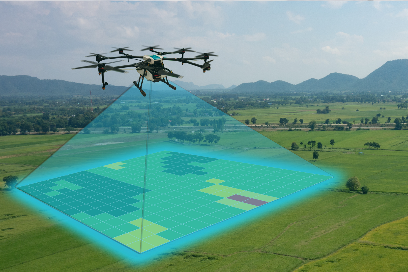
Drone software usually turns scan results into easy-to-read maps. These maps highlight problem zones in colours—red for trouble, green for healthy. That’s useful, but the real power comes from pairing these visuals with action.
Say a drone finds uneven growth in a wheat paddock. You might then:
- Pull soil samples from that red zone
- Check irrigation flow
- Adjust nutrient levels or spray applications
- Reseed if the patch was missed during planting
Over time, you can track how each change impacts the map. This builds confidence in your decision-making and shows whether inputs are working or being wasted. The benefits of agricultural drones for efficiency and sustainability are clearer when every pass is measured and improved.
Saving Time, Money and Resources
Every farmer knows that time is tight and inputs aren’t cheap. Using drone data to target effort and spending is a major win.
Instead of treating every hectare the same, drone scans highlight where resources are needed most. That could mean spraying just one strip for pests or holding off on fertiliser where growth is already strong. It’s a shift from blanket coverage to targeted care.
Here’s how it adds up:
- Lower input costs: Spray, fertiliser and seed only where it’s needed
- Less labour time: Fewer field inspections and repeat jobs
- Reduced waste: Better water use and fewer over-applications
- Better margins: Optimise yield by managing risks early
On a large operation, even a 5% improvement in efficiency can mean thousands of dollars saved over a season.
Real-World Example: Barley in WA’s Wheatbelt
One grower near Merredin faced a common challenge—variable soil performance across a broadacre barley crop. They introduced drone scans mid-season, using NDVI data to pinpoint underperforming zones.
Instead of respraying the entire field, they adjusted nitrogen levels only in the low-vigour sections. The drone also found irrigation overlap areas, helping to adjust nozzle settings.
By harvest, they saw an 11% improvement in yield from targeted management, plus a noticeable cut in input costs. The drone didn’t just give information—it gave them the confidence to act with precision.
Helping with Crop Planning and Rotation
Drone data isn’t just for in-season decisions. It helps with year-to-year planning too. When you fly at the same time each season, you start building a record. This reveals trends, patterns and trouble spots over time.
That kind of history is valuable when choosing next season’s crop or deciding on rotations. You can see where disease pressure hit hardest, where the soil stayed too wet, or which sections consistently lagged behind.
With this data, you’re no longer relying on memory or guesswork. You’ve got proof in hand to guide smarter planning decisions.
Boosting Biosecurity and Risk Management
Early detection is critical when it comes to pests, disease or chemical resistance. Drones help spot these issues before they get out of control.
Imagine catching signs of a fungal infection two weeks earlier than normal. That lead time can save an entire crop and prevent the spread to neighbouring blocks. The same goes for detecting spray drift or waterlogging.
Drones can also be used for biosecurity compliance—providing documented proof of crop condition and treatment. For farmers in supply chains with traceability requirements, this builds trust with buyers and keeps you ahead of regulation.
Integrating Drone Data with Other Farm Tech
Drone data isn’t an island—it works best when plugged into your wider farm management system. Many software platforms now let you upload drone maps directly into your paddock records.
This means:
- Syncing drone scans with yield maps
- Linking issues to spray logs
- Tracking crop performance by zone
- Comparing data across seasons
It creates a single source of truth. And it’s not just for the big players—plenty of tools are now designed for small to mid-size operations too.
What’s Coming Next in Drone Data?
Tech is always moving, and drone data is no exception. Here’s what’s on the horizon:
- AI-powered insights: Systems that auto-flag issues and suggest treatments
- Live-streaming drones: Instant views without waiting for uploads
- Swarm drones: Multiple units working together to scan large areas
- Predictive modelling: Using drone data to forecast crop outcomes
As drone prices fall and software improves, expect more automation, better analysis and easier access. The future’s not just about having the data—it’s about having smart tools to make sense of it fast.
FAQs
1) How accurate is drone data for farming?
Drone data can be incredibly accurate, especially when using high-end sensors like multispectral or LiDAR. Most modern drones provide centimetre-level precision, depending on altitude and conditions.
That said, accuracy also depends on how well the data is processed. Raw images need to be stitched and aligned correctly. That’s why it’s best to use software built for ag mapping—it handles calibration and filtering for you.
Farmers using drone data report strong consistency when comparing results to ground checks. Whether it’s plant health, soil temperature or terrain mapping, the accuracy is more than good enough for decision-making. Just be sure to fly regularly, follow best practices, and compare data to your known benchmarks when starting out.
2) What’s the difference between RGB and multispectral drone data?
RGB is your standard colour photo—the kind you’d see from a regular camera. It’s good for spotting visible damage, gaps in crops, wheel tracks or animal impact. You can also zoom in and get high-resolution images for closer inspection.
Multispectral, on the other hand, captures data beyond human vision. It measures wavelengths like near-infrared, which plants reflect differently based on health. That’s where NDVI maps come in, showing how well crops are photosynthesising.
If you want general views and simple scouting, RGB works. But if you’re serious about measuring crop stress, monitoring nutrition or spotting disease early, multispectral offers far more depth. Many farmers start with RGB and move into multispectral once they’re comfortable reading the data.
3) How often should I scan my crops with a drone?
The short answer? It depends on the crop and your goals. For broadacre crops like wheat or canola, scanning every 2–3 weeks during the growing season is a solid start. This helps track growth stages, flag issues early and guide spray or fert applications.
For high-value crops like grapes, veg or citrus, weekly or even twice-weekly flights are common. These crops respond fast to stress, and early action makes a big difference.
Some farmers scan before and after key events—planting, top-dressing, major sprays or irrigation changes. Others build a set calendar to ensure consistent comparisons year to year.
The key is finding a rhythm that matches your crop cycle and resource availability. You don’t need to scan daily—but the more consistent the data, the better the decisions.
4) Can I use drone data without being tech-savvy?
Yes, absolutely. While the tech behind drone data is complex, the tools designed for farmers are getting simpler. Many systems now do the heavy lifting in the background—stitching images, colouring maps and flagging issues automatically.
Most platforms work via apps or desktop dashboards. If you can use basic mapping tools like Google Maps, you’ll find the interface pretty familiar.
Plenty of ag service providers also offer drone data as a service. They fly the drones, process the maps and send you the insights. That way, you get the benefits without needing to be a tech expert.
The goal isn’t to turn farmers into software engineers—it’s to make the data usable, actionable and easy to trust.
5) Is drone data worth the cost for smaller farms?
In many cases, yes. The return on investment comes from smarter decisions—not from owning the flashiest drone.
Smaller farms often operate with tighter margins and can’t afford waste. Drone data helps them spend inputs where it counts, avoid unnecessary treatments and get ahead of problems. Even a few hundred dollars saved per hectare adds up fast.
You don’t need to buy top-tier gear either. Entry-level drones can still provide useful data, especially when paired with a good agronomy service. And many farmers start by hiring a drone contractor rather than buying equipment upfront.
Bottom line: drone data isn’t just for big operators. It’s for any farmer who wants to work smarter, protect yield and cut waste.
Harnessing the Power of Insight from Above
Drone data has become one of the most useful tools on modern farms—not because it looks high-tech, but because it makes decisions clearer and faster. When you can see exactly where problems are brewing or where growth is lagging, you can act with purpose.
It’s this mix of accuracy, speed and clarity that makes drone data a smart investment for farmers across Australia. Whether you’re managing 100 hectares or 10,000, the ability to make better choices with real-time insight is a major step forward.
Ready to get started? Explore how agricultural drones from Precision Ag Services can bring real-time data and practical insight to your paddock today.
Please fill out our enquiry form for more information or to make a booking.